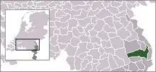
| Municipo Horst aan de Maas | ||
|---|---|---|
|
|
| |
| Flago de la municipo Horst aan de Maas | Blazono de municipo Horst aan de Maas | |
 | ||
| nederlanda municipo | ||
| Provinco | Limburgo | |
| Ĉefloko | Horst | |
| Areo - Tero - Akvo |
122,55 km² 119,98 km² 2,57 km² | |
| Loĝantaro - Loĝdenso |
41 820 (1-a de novembro 2012) 349 loĝ./km² | |
| Geografia situo | 51° 26′ N, 6° 6′ O (mapo)51.4333333333336.1Koordinatoj: 51° 26′ N, 6° 6′ O (mapo) | |
| ||
|
| ||
| Gravaj trafikaj arterioj | A67, A73 | |
| CBS-municipokodo | 1507 | |
| Telefona kodo | 0478 | |
| Poŝtkodo | 5864-5866, 5871-5872, 5960-5966, 5971, 5973, 5975-5977 | |
| Oficiala retejo | https://www.horstaandemaas.nl/ | |
Horst aan de Maas estas urbo kaj municipo en la nederlanda provinco Limburgo.
Ĝia parto Lottum portas la kromnomon "rozurbo".
Ĝemelurbo
| Provinco Limburgo | |
|---|---|
| Beek | Beekdaelen | Beesel | Bergen | Brunssum | Echt-Susteren | Eijsden-Margraten | Gennep | Gulpen-Wittem | Heerlen | Horst aan de Maas | Kerkrade | Landgraaf | Leudal | Maasgouw | Mastriĥto | Meerssen | Mook en Middelaar | Nederweert | Peel en Maas | Roerdalen | Roermond | Schinnen | Simpelveld | Sittard-Geleen | Vaals | Valkenburg aan de Geul | Venlo | Venray | Voerendaal | Weert | |
| Nederlando | Provincoj | Municipoj | |
This article is issued from Wikipedia. The text is licensed under Creative Commons - Attribution - Sharealike. Additional terms may apply for the media files.


