| Herefordshire | ||||
|---|---|---|---|---|
| Unuara instanco | ||||
 | ||||
 |  | |||
| Flago | Blazono | |||
| ceremonia kantono de Anglio • unitary authority area in England [+] | ||||
| Lando | Anglio | |||
| Koordinatoj | 52° N, 3° U (mapo)52.083333333333-2.75Koordinatoj: 52° N, 3° U (mapo) | |||
| Ĉefurbo | Hereford | |||
| - koordinatoj | 52° N, 3° U (mapo)52.083333333333-2.75Koordinatoj: 52° N, 3° U (mapo) [+] | |||
| Areo | 2 179,7094 km² (217 971 ha) [+] | |||
| Loĝantaro | 193 615 [+] (2020) | |||
| ISO 3166-2 | GB-HEF | |||
|
||||
|
||||
 |
||||
| Herefordshire | ||||
| En TTT: Oficiala retejo [+] | ||||
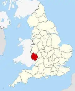
Herefordshire estas unuara instanco en la angla regiono West Midlands. Laŭ stato de la jaro 1997, en la teritorio vivis 166 000 loĝantoj. Ĝi kovras areon de 2 180 kvadrataj kilometroj.
- Urboj kaj vilaĝoj
- Bacton, Blackwardine, Bromyard
- Eye
- Goodrich
- Hereford, Hoarwithy, Huntington
- Kilpeck, Kington, Kingstone
- Ledbury, Leominster
- Mansel Lacy, Marden, Marston, Marston Stannett, Marstow
- Pembridge
- Ross-on-Wye
- Whitbourne, Whitchurch
- Vizitindaĵoj
- Abbey Dore
- Hereford Cathedral
- Malvern Hills
Vidu ankaŭ
Eksteraj ligiloj
| ||||||
This article is issued from Wikipedia. The text is licensed under Creative Commons - Attribution - Sharealike. Additional terms may apply for the media files.

