| La Rochelle - île de Ré | |||||
|---|---|---|---|---|---|
 | |||||
| flughaveno • aerodromo de komerca trafiko | |||||
| IATA: LRH ICAO: LFBH | |||||
| Resuma informo | |||||
| Lando | Francio | ||||
| Regiono | Charente-Maritime | ||||
| Tipo | Civila flughaveno | ||||
| Apuda urbo | La Rochelle | ||||
| Alteco | 23 m | ||||
| Geografia situo | 46° 10′ 15″ N, 1° 11′ 43″ U (mapo)46.170833333333-1.1952777777778Koordinatoj: 46° 10′ 15″ N, 1° 11′ 43″ U (mapo) | ||||
| |||||
| Kurej-angulo | 09/27 | ||||
| Kurej-longo | 2255 | ||||
| Retejo | www.larochelle.aeroport.fr | ||||
La flughaveno La Rochelle - île de Ré estas flughaveno en La Rochelle, en okcidenta Francio. Ĝi estas uzata por enlanda kaj internacia transporto kaj por turisma aviado.
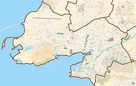
Ĝi situas en la nordokcidenta parto de La Rochelle, 2,5 km de la urbocentro, kaj tre proksime al la ponto de la insulo Ré.
Flugoj
De La Rochelle eblas flugi al pluraj urboj en okcidenta Eŭropo (kelkaj nur somere):
Vidu ankaŭ
Eksteraj ligiloj
This article is issued from Wikipedia. The text is licensed under Creative Commons - Attribution - Sharealike. Additional terms may apply for the media files.
