| Municipo Best | ||
|---|---|---|
|
|
| |
| Flago de la municipo Best | Blazono de municipo Best | |
 | ||
| nederlanda municipo • urbeto • loĝloko en Nederlando | ||
| Provinco | Nord-Brabanto | |
| Ĉefloko | Best | |
| Areo - Tero - Akvo |
35,10 km² 34,31 km² 0,79 km² | |
| Loĝantaro - Loĝdenso |
28.594 (1-a de januaro 2014) 833 loĝ./km² | |
| Geografia situo | 51° 31′ N, 5° 24′ O (mapo)51.5108335.392222Koordinatoj: 51° 31′ N, 5° 24′ O (mapo) | |
| ||
|
| ||
| CBS-municipokodo | 0753 | |
| Telefona kodo | 0499 | |
| Poŝtkodo | 5680–5685 | |
| Oficiala retejo | https://www.gemeentebest.nl/ | |

Mapo de la Best en 1865

Topografia mapo de Best, marto 2014
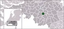
Best (![]() prononco) estas municipo en la provinco Nord-Brabanto. La teritorio de la municipo antaŭe apartenis al la municipo Oirschot, sed en 1819 ĝi fariĝis memstara municipo.
prononco) estas municipo en la provinco Nord-Brabanto. La teritorio de la municipo antaŭe apartenis al la municipo Oirschot, sed en 1819 ĝi fariĝis memstara municipo.
La municipo havis 28 594 loĝantojn en 2014 kaj areo de 35,10 km².
En la regiono oni antaŭe faris multajn lignoŝuojn, tio ankoraŭ videblas pro la multaj poploj en la pejzaĝo.

Kirko
| Provinco Nord-Brabanto | |
|---|---|
| Aalburg | Alphen-Chaam | Asten | Baarle-Nassau | Bergeijk | Bergen op Zoom | Bernheze | Best | Bladel | Boekel | Boxmeer | Boxtel | Breda | Cranendonck | Cuijk | Deurne | Dongen | Drimmelen | Eersel | Eindhoven | Etten-Leur | Geertruidenberg | Geldrop-Mierlo | Gemert-Bakel | Gilze en Rijen | Goirle | Grave | Haaren | Halderberge | Heeze-Leende | Helmond | 's-Hertogenbosch | Heusden | Hilvarenbeek | Laarbeek | Landerd | Loon op Zand | Meierijstad | Mill en Sint Hubert | Moerdijk | Nuenen, Gerwen en Nederwetten | Oirschot | Oisterwijk | Oosterhout | Oss | Reusel-De Mierden | Roosendaal | Rucphen | Sint Anthonis | Sint-Michielsgestel | Someren | Son en Breugel | Steenbergen | Tilburg | Uden | Valkenswaard | Veldhoven | Vught | Waalre | Waalwijk | Woensdrecht | Woudrichem | Zundert | |
| Nederlando | Provincoj | Municipoj | |
This article is issued from Wikipedia. The text is licensed under Creative Commons - Attribution - Sharealike. Additional terms may apply for the media files.


