Saint-Chaffrey
Saint-Chaffrey (auf okzitanisch Sant Chafrèi) ist eine französische Gemeinde im Département Hautes-Alpes in der Region Provence-Alpes-Côte d’Azur. Sie gehört zum Arrondissement Briançon und zum Kanton Briançon-1.
| Saint-Chaffrey | ||
|---|---|---|

|
| |
| Staat | Frankreich | |
| Region | Provence-Alpes-Côte d’Azur | |
| Département (Nr.) | Hautes-Alpes (05) | |
| Arrondissement | Briançon | |
| Kanton | Briançon-1 | |
| Gemeindeverband | Briançonnais | |
| Koordinaten | 44° 56′ N, 6° 36′ O | |
| Höhe | 1274–2413 m | |
| Fläche | 25,88 km² | |
| Einwohner | 1.515 (1. Januar 2021) | |
| Bevölkerungsdichte | 59 Einw./km² | |
| Postleitzahl | 05330 | |
| INSEE-Code | 05133 | |
 Mairie Saint-Chaffrey | ||

Geographie
Das Dorf liegt auf 1365 m im Tal des Flusses Guisane. Der Col de Granon ist ein 2413 m hoher Pass bei Saint-Chaffrey.
Die angrenzenden Gemeinden sind:
- Val-des-Prés im Nordosten,
- Briançon und Puy-Saint-Pierre im Südosten,
- Puy-Saint-André im Südwesten,
- La Salle-les-Alpes im Nordwesten.
Bevölkerungsentwicklung
| Jahr | 1962 | 1968 | 1975 | 1982 | 1990 | 1999 | 2008 | 2012 |
|---|---|---|---|---|---|---|---|---|
| Einwohner | 844 | 831 | 947 | 1287 | 1424 | 1569 | 1662 | 1663 |
Sehenswürdigkeiten
- Haus mit Sonnenuhr von Zarbula, Monument historique
- Kirche Saint-Arnould, Monument historique
- Kirche Saint-Chaffrey, Monument historique
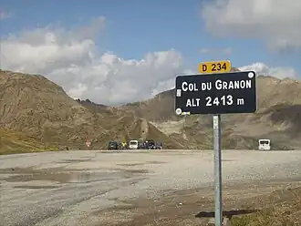 Col du Granon
 Kirche Saint-Chaffrey
Weblinks
Commons: Saint-Chaffrey – Sammlung von Bildern, Videos und Audiodateien
This article is issued from Wikipedia. The text is licensed under Creative Commons - Attribution - Sharealike. Additional terms may apply for the media files.