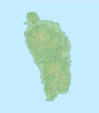
Morne Fraser
Morne La Source ist mit seinem zweiten Gipfel Morne Fraser (693 m) das landschaftsbestimmende vulkanische Bergmassiv im Carib Territory im Inselstaat Dominica.
| Morne La Source | ||
|---|---|---|
| Höhe | 690 m | |
| Lage | Dominica | |
| Koordinaten | 15° 27′ 7″ N, 61° 16′ 39″ W | |
| ||
| Typ | Schichtvulkan | |
Geographie
Der Berg befindet sich im Osten des Landes auf dem Gebiet des Parish Saint David. Zahlreiche Bäche entspringen in den Hängen des Berges, unter anderem Charles Warner River, Ravine Bois Diable, Salibia River, Kusarakua und Wakaman River, sowie vom Südhang Zuflüsse des Castle Bruce River (Yellow River). Die bedeutendsten Siedlungen im Umkreis sind Castle Bruce und Crayfish River.
Quellen
- Michal Kasprowski: Commonwealth of Dominica Street Map. (1:40.000, Customized Printing).
Literatur
- A.L. Smith, M.J. Roobol, G.S. Mattioli, J.E. Fryxell, G.E. Daly, L.A. Fernandez: The Volcanic Geology of the Mid-Arc Island of Dominica. [Geological Society of America Special Paper; Bd. 496] Geological Society of America 2013. ISBN 0813724961, 9780813724966
Weblinks
This article is issued from Wikipedia. The text is licensed under Creative Commons - Attribution - Sharealike. Additional terms may apply for the media files.
