Magpet
Magpet ist eine philippinische Stadtgemeinde in der Provinz Cotabato. Sie hat 49.201 Einwohner (Zensus 1. August 2015). Teile der Gemeinde liegen im Mount Apo Natural Park.
| Municipality of Magpet | |||
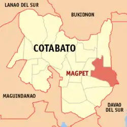
| Lage von Magpet in der Provinz Cotabato | |||
|---|---|---|---|
 | |||
| Basisdaten | |||
| Region: | SOCCSKSARGEN | ||
| Provinz: | Cotabato | ||
| Barangays: | 32 | ||
| Distrikt: | 2. Distrikt von Cotabato | ||
| PSGC: | 124706000 | ||
| Einkommensklasse: | 1. Einkommensklasse | ||
| Haushalte: | 7465 Zensus 1. Mai 2000 | ||
| Einwohnerzahl: | 49.201 Zensus 1. August 2015 | ||
| Koordinaten: | 7° 7′ N, 125° 7′ O | ||
| Postleitzahl: | 9404 | ||
| Bürgermeister: | Efren Sr.F. Diñol | ||
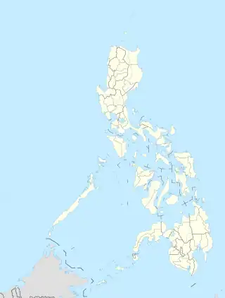
| Geographische Lage auf den Philippinen | |||
| |||
Baranggays
Magpet ist politisch in 32 Baranggays unterteilt:
- Alibayon
- Bagumbayan
- Bangkal
- Bantac
- Basak
- Binay
- Bongolanon
- Datu Celo
- Del Pilar
- Doles
- Gubatan
- Ilian
- Inac
- Kamada
- Kauswagan
- Kisandal
- Magcaalam
- Mahongcog
- Manobo
- Noa
- Owas
- Pangao-an
- Poblacion
- Sallab
- Tagbac
- Temporan
- Amabel
- Balete
- Don Panaca
- Imamaling
- Kinarum
- Manobisa
This article is issued from Wikipedia. The text is licensed under Creative Commons - Attribution - Sharealike. Additional terms may apply for the media files.