Forrester Island (Antarktika)
Forrester Island ist eine vereiste und 5,6 km lange Insel vor der Hobbs-Küste des westantarktischen Marie-Byrd-Lands. Sie liegt 22 km nordnordöstlich der vom Getz-Schelfeis umschlossenen Insel Shepard Island, von der sie durch die Reynolds Strait getrennt ist.
| Forrester Island | ||
|---|---|---|
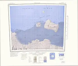
 Topographisches Kartenblatt von Grant Island (1:250.000) mit der nördlich dazu gelegenen Insel Forrester Island | ||
| Gewässer | Südlicher Ozean | |
| Geographische Lage | 74° 9′ 0″ S, 132° 13′ 0″ W | |
| ||
| Länge | 5,6 km | |
| Einwohner | unbewohnt | |
Entdeckt und kartiert wurde die Landspitze am 5. Februar 1962 von Bord des Eisbrechers USS Glacier unter Kapitän Edwin Anderson McDonald (1907–1988). Das Advisory Committee on Antarctic Names benannte sie 1962 nach Lieutenant Commander John J. Forrester, zu dieser Zeit Executive Officer der USS Glacier.
Weblinks
- Forrester Island. In: Geographic Names Information System. United States Geological Survey, United States Department of the Interior, archiviert vom (englisch).
- Forrester Island auf geographic.org (englisch)
This article is issued from Wikipedia. The text is licensed under Creative Commons - Attribution - Sharealike. Additional terms may apply for the media files.
