Foho Saburai
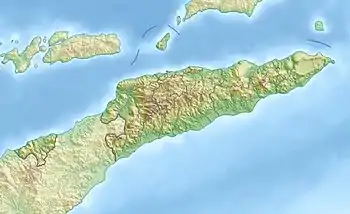
Der Foho Saburai, kurz Saburai, ist ein 1713 m hoher Berg in Osttimor.[1] Er befindet sich an der Grenze der Aldeias Cossal und Tazmasac, im Osten des Sucos Saburai (Verwaltungsamt Bobonaro, Gemeinde Bobonaro). Südlich liegt der Tapo, der höchste Berg der Gemeinde Bobonaro.[2]
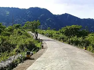
 Aufstieg zum Gipfel
 Wald am Berghang
 Kalksteinformation
 Am Gipfel
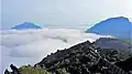 Am Gipfel
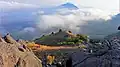 Blick vom Gipfel
| Saburai | ||
|---|---|---|
Der Saburai | ||
| Höhe | 1934 m | |
| Lage | Suco Saburai, Verwaltungsamt Bobonaro, Gemeinde Bobonaro, Osttimor | |
| Koordinaten | 9° 3′ 54″ S, 125° 13′ 48″ O | |
| ||
Weblinks
Commons: Foho Saburai – Sammlung von Bildern, Videos und Audiodateien
Einzelnachweise
- Profil des Distrikts 2012, S. 8 (tetum; PDF)
- Direcção-Geral de Estatística: Atlas der Gemeinde Bobonaro, abgerufen am 25. September 2022.
This article is issued from Wikipedia. The text is licensed under Creative Commons - Attribution - Sharealike. Additional terms may apply for the media files.