Escalante River
Der Escalante River ist ein etwa 145 km langer Nebenfluss des Colorado River im Süden des US-Bundesstaats Utah. Er entspringt im Westen des Garfield County, fließt bei Escalante durch den Dixie National Forest, danach nach Osten durch das Grand Staircase-Escalante National Monument, bis er in den Colorado River mündet.
| Escalante River | ||
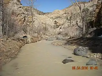 Escalante River nahe Escalante Escalante River nahe Escalante | ||
| Daten | ||
| Lage | Utah, USA | |
| Flusssystem | Colorado River → Golf von Kalifornien | |
| Quelle | Garfield County 37° 45′ 55″ N, 111° 40′ 59″ W | |
| Mündung | in den Colorado River 37° 17′ 22″ N, 110° 52′ 20″ W
| |
| Länge | 145 km | |
Weblinks
Commons: Escalante River – Sammlung von Bildern, Videos und Audiodateien
Escalante River. In: Geographic Names Information System. United States Geological Survey, United States Department of the Interior (englisch).
This article is issued from Wikipedia. The text is licensed under Creative Commons - Attribution - Sharealike. Additional terms may apply for the media files.