Culion
Culion ist eine philippinische Insel (englisch Culion Island)[1] und gleichzeitig Stadtgemeinde in der Provinz Palawan. Sie hat 20.139 Einwohner (Zensus 1. August 2015).
| Culion | ||
|---|---|---|
 Satellitenbild von Culion Island | ||
| Gewässer | Sulusee | |
| Inselgruppe | Calamian-Inseln | |
| Geographische Lage | 11° 50′ N, 119° 57′ O | |
| ||
| Fläche | 389 km² | |
| Höchste Erhebung | Mount Oltaloro 468 m | |

| Municipality of Culion | |||
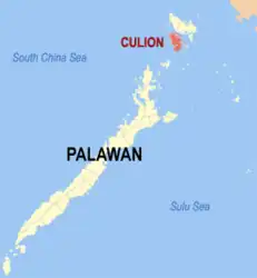
| Lage von Culion in der Provinz Palawan | |||
|---|---|---|---|
 | |||
| Basisdaten | |||
| Region: | MIMAROPA | ||
| Provinz: | Palawan | ||
| Barangays: | 13 | ||
| Distrikt: | 1. Distrikt von Palawan | ||
| PSGC: | 175322000 | ||
| Einkommensklasse: | 3. Einkommensklasse | ||
| Haushalte: | 3082 Zensus 1. Mai 2000 | ||
| Einwohnerzahl: | 20.139 Zensus 1. August 2015 | ||
| Koordinaten: | 11° 53′ N, 120° 1′ O | ||
| Postleitzahl: | 5315 | ||
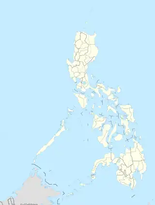
| Geographische Lage auf den Philippinen | |||
| |||
Hier gibt es Vorkommen des seltenen Calamian-Hirschs. In der Gemeinde ist das Loyola College of Culion und ein Campus der Western Philippines University angesiedelt.
Baranggays
Culion ist politisch in 13 Baranggays unterteilt.
- Balala
- Baldat
- Binudac
- Culango
- Galoc
- Jardin
- Libis
- Luac
- Malaking Patag
- Osmeña
- Tiza
- Pescadores
- Chindonan
This article is issued from Wikipedia. The text is licensed under Creative Commons - Attribution - Sharealike. Additional terms may apply for the media files.