Cataract-Nationalpark
Der Cataract-Nationalpark ist ein Nationalpark im Nordosten des australischen Bundesstaates New South Wales, etwa 50 Kilometer nordöstlich von Tenterfield und rund 88 Kilometer westlich von Lismore.[1]
| Cataract-Nationalpark | |||
|---|---|---|---|
| |||
| Lage: | New South Wales, Australien | ||
| Nächste Stadt: | Pretty Gully | ||
| Fläche: | 34,06 km² | ||
| Gründung: | 1. Januar 2003 | ||
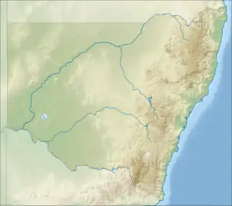
Der Nationalpark liegt am Nordufer des Cataract River und am Bangala Creek, beides Nebenflüsse des Clarence River.[1]
Weblinks
- Cataract National Park im NSW National Parks and Wildlife Service
Einzelnachweise
- Steve Parish: Australian Touring Atlas. Steve Parish Publishing, Archerfield Queensland 2007, ISBN 978-1-74193-232-4, S. 29.
A Abercrombie River | Arakoon | Arakwal | B Bago Bluff | Bald Rock | Bangadilly | Barakee | Barool | Barrington Tops | Basket Swamp | Belford | Bellinger River | Benambra | Bendick | Ben Halls Gap | Beowa | Berowra | Bimberamala | Bindarri | Biriwal-Bulga | Blue Mountains | Bongil Bongil | Boonoo-Boonoo | Booti-Booti | Border Ranges | Botany Bay | Bouddi | Bournda | Brindabella | Brisbane Water | Broadwater | Budawang | Budderoo | Bugong | Bundjalung | Bungawalbin | Bungonia | Butterleaf | C Capoompeta | Carrai | Cascade | Cataract | Cathedral Rock | Cattai | Chaelundi | Clyde River | Cocoparra | Columbey | Conimbla | Conjola | Coolah Tops | Coorabakh | Cottan-Bimbang | Crowdy Bay | Culgoa | Cunnawarra | Curracabundi | D Dharawal | Deua | Dharug | Dooragan | Dorrigo | Dunggir | E Eurobodalla | F Fortis Creek | G Gaagal Wanggaan | Gardens of Stone | Garigal | Garrawilla | Georges River | Ghin Doo Ee | Gibraltar Range | Gir-um-bit | Gondwana-Regenwälder | Goobang | Goolawah | Goonengerry | Goulburn River | Gourock | Gulaga | Gumbaynggirr | Gundabooka | Guy Fawkes River | H Hat Head | Heathcote | Hunter Wetlands | I Indwarra | J Jerrawangala | Jervis Bay | Junuy Juluum | K Kalyarr | Kanangra-Boyd | Karuah | Kemendok | Keverstone | Kinchega | Kings Plains | Kooraban | Koreelah | Kosciuszko | Kumbatine | Ku-ring-gai-Chase | Kwiambal | L Lachlan Valley | Lane Cove | Livingstone | M Macquarie Pass | Mallanganee | Mallee Cliffs | Mares Forest | Maria | Marramarra | Marrangaroo | Maryland | Mebbin | Meroo | Middle-Brother | Mimosa Rocks | Minjary | Monga | Mooball | Morton | Mount Clunie | Mount Imlay | Mount Jerusalem | Mount Kaputar | Mount Nothofagus | Mount Pikapene | Mount Royal | Mount Warning | Mummel Gulf | Mungo | Murramarang | Murray Valley | Mutawintji | Myall Lakes | N Nangar | Nattai | New England | Nightcap | Nowendoc | Nymboi-Binderay | Nymboida | O Oolambeyan | Oxley-Wild-Rivers | P Paroo-Darling | Popran | R Ramornie | Richmond Range | Royal | S Saltwater | Scheyville | Scone Mountain | Seven Mile Beach | Single | South East Forest | Sturt | Sydney Harbour | T Tallaganda | Tapin Tops | Tarlo River | Thirlmere Lakes | Tilligerry | Timbarra | Tomaree | Tooloom | Toonumbar | Toorale | |Towarri | Turon | U Ulidarra | W Wadbilliga | Wallarah | Wallaroo | Wallingat | Warra | Warrabah | Warrumbungle | Washpool | Watagans | Weddin Mountains | Werakata | Werrikimbe | Willandra | Willi-Willi | Woko | Wollemi | Wollumbin | Woolooma | Woomargama | Worimi | Wyrrabalong | Y Yabbra | Yanga | Yanununbeyan | Yarriabini | Yarrahapinni Wetlands | Yengo | Yuraygir