Callengeville
Callengeville ist eine französische Gemeinde mit 502 Einwohnern (Stand 1. Januar 2021) im Département Seine-Maritime in der Region Normandie. Sie gehört zum Arrondissement Dieppe und zum Kanton Neufchâtel-en-Bray. Die Bewohner werden Callengevillais und Callengevillaises genannt.
| Callengeville | ||
|---|---|---|
| ||
| Staat | Frankreich | |
| Region | Normandie | |
| Département (Nr.) | Seine-Maritime (76) | |
| Arrondissement | Dieppe | |
| Kanton | Neufchâtel-en-Bray | |
| Gemeindeverband | Communauté Bray-Eawy | |
| Koordinaten | 49° 49′ N, 1° 31′ O | |
| Höhe | 154–231 m | |
| Fläche | 17,13 km² | |
| Einwohner | 502 (1. Januar 2021) | |
| Bevölkerungsdichte | 29 Einw./km² | |
| Postleitzahl | 76270 | |
| INSEE-Code | 76122 | |
 Bürgermeisteramt (Mairie) | ||
Die Gemeinde wurde 1973 durch den Zusammenschluss von Bosc-Geffroy und Les Essarts-Varimprés gebildet.
Geographie
Callengeville liegt östlich des Zentrum des Départements in der Landschaft Pays de Bray, etwa 51 Kilometer nordöstlich von Rouen und etwa 34 Kilometer südöstlich von Dieppe.
Umgeben wird Callengeville von den acht Nachbargemeinden:
| Smermesnil | Preuseville Fallencourt |
Foucarmont |
| Clais | .svg.png.webp) |
Villers-sous-Foucarmont |
| Fesques | Vatierville |
Durch die Gemeinde führt die Autoroute A28.
Bevölkerungsentwicklung
| Jahr | 1962 | 1968 | 1975 | 1982 | 1990 | 1999 | 2007 | 2015 |
| Einwohner | 253 | 252 | 462 | 466 | 491 | 455 | 472 | 519 |
Sehenswürdigkeiten
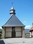
- Kirche Saint-Laurent in Bosc-Geffroy aus dem 16. Jahrhundert
- Kirche Saint-Mathurin in Les Essarts aus dem 18. Jahrhundert
_France.jpg.webp) Kirche Saint-Laurent
Kirche Saint-Laurent Kirche Saint-Mathurin
This article is issued from Wikipedia. The text is licensed under Creative Commons - Attribution - Sharealike. Additional terms may apply for the media files.
