Bloomingdale (Ohio)
Bloomingdale ist ein Village im Jefferson County des US-Bundesstaates Ohio. Im Jahr 2010 hatte Bloomingdale 202 Einwohner.
| Bloomingdale | |
|---|---|
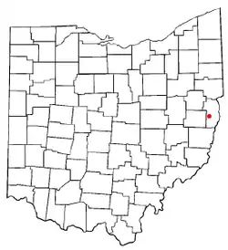
  Karte von Ohio, Bloomingdale hervorgehoben | |
| Basisdaten | |
| Gründung: | 1816 |
| Staat: | Vereinigte Staaten |
| Bundesstaat: | Ohio |
| County: | Jefferson County |
| Koordinaten: | 40° 21′ N, 80° 49′ W |
| Zeitzone: | Eastern (UTC−5/−4) |
| Einwohner: | 145 (Stand: 2020) |
| Haushalte: | 57 (Stand: 2020) |
| Fläche: | 0,23 km² (ca. 0 mi²) davon 0,23 km² (ca. 0 mi²) Land |
| Bevölkerungsdichte: | 630 Einwohner je km² |
| Höhe: | 385 m |
| Postleitzahl: | 43910 |
| Vorwahl: | +1 740 |
| FIPS: | 39-07202 |
| GNIS-ID: | 1038125 |
Geographie
Umgeben wird Bloomingdale von East Springfield und von Richmond im Norden und von Wintersville und Steubenville im Osten.
This article is issued from Wikipedia. The text is licensed under Creative Commons - Attribution - Sharealike. Additional terms may apply for the media files.