Garchitorena
An Garchitorena sarong ikaapat na klaseng banwaan sa probinsya kan Camarines Sur, Filipinas. An designadong zip code kaini iyo an 4428.
Garchitorena | |
|---|---|
 Kinamumugtakan kan Garchitorena | |
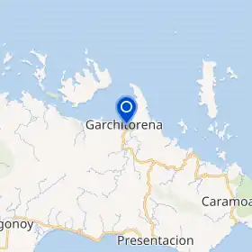 | |
| Tagboan: 13°52′48″N 123°42′0″E | |
| Nasyon | Filipinas |
| Barangay | 23 |
| Pamamahala | |
| • Electorado | 18,388 votantes (9 Mayo 2022) |
| Hiwas | |
| • Kabuuhan | 243.80 km2 (94.13 sq mi) |
| Elebasyon | 30 m (100 ft) |
| Populasyon (Mayo 1, 2020)[1] | |
| • kabuuhan | 29,436 |
| • Densidad | 120/km2 (310/sq mi) |
| • Saro | 6,013 |
| Economia | |
| • Klase | ikaapat na klaseng banwaan |
| • Ingresos | ₱169,366,801.03 (2020) |
| • Activos | ₱394,360,984.73 (2020) |
| • Pasivos | ₱77,267,089.63 (2020) |
| • Gastos | ₱131,792,537.16 (2020) |
| Kodigo nin postal | 4428 |
| PSGC | 051714000 |
| Kodigo telefonico | 54 |
| Tataramon | Bikol Sentral tataramon na Tagalog |
Susog sa sensus kan 1 Mayo 2020, igwa ining 29,436 katawong nag-eerok digdi sa 6,013 kaharongan. Igwa ining sukol na 243.80 kilometro kwadrado.
Mga barangay
Nababanga an Garchitorena sa 23 barangay.
- Ason (Anson)
- Bahi
- Binagasbasan
- Burabod
- Cagamutan
- Cagnipa
- Canlong
- Dangla
- Del Pilar
- Denrica
- Harrison
- Mansangat
- Pambuhan
- Barangay I (Pob.)
- Barangay II (Pob.)
- Barangay III (Pob.)
- Barangay IV (Pob.)
- Sagrada
- Salvacion
- San Vicente
- Sumaoy
- Tamiawon
- Toytoy
Demograpiko
| Taon | Tawo | ±% p.a. |
|---|---|---|
| 1960 | 10,191 | — |
| 1970 | 15,890 | +4.54% |
| 1975 | 16,438 | +0.68% |
| 1980 | 16,877 | +0.53% |
| 1990 | 19,439 | +1.42% |
| 1995 | 19,481 | +0.04% |
| 2000 | 23,021 | +3.64% |
| 2007 | 24,825 | +1.05% |
| 2010 | 25,204 | +0.55% |
| 2015 | 27,010 | +1.33% |
| 2020 | 29,436 | +1.71% |
| Toltolan: Philippine Statistics Authority[2][3][4][5] | ||
Toltolan
- "2020 Census of Population and Housing (2020 CPH) Population Counts Declared Official by the President". Hulyo 7, 2021. Check date values in:
|date=(help) - Sensus kan Populasyon (2015). "Rehiyon V (Rehiyon Bikol)". Kabuuhang Populasyon kan lambang Provincia, Syudad, Banwaan asin Barangay. PSA. Retrieved 20 Jun 2016.
- Census of Population and Housing (2010). "Rehiyon V (Rehiyon Bikol)". Kabuuhan populasyon sa lambang Provincia, Syudad, Banwaan asin Barangay. NSO. Retrieved 29 Jun 2016.
- Mga Sensus kan Populasyon (1903–2007). "Rehiyon V (Rehiyon Bikol)". Table 1. Population Enumerated in Various Censuses by Province/Highly Urbanized City: 1903 to 2007. NSO.
- "Province of Camarines Sur". Municipality Population Data. LWUA Research Division. Retrieved 17 December 2016.
Mga panluwas na takod
Pili (kapitolyo) | |
| Banwaan | |
| Syudad | |
This article is issued from Wikipedia. The text is licensed under Creative Commons - Attribution - Sharealike. Additional terms may apply for the media files.