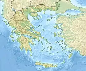
Kitira boğazı
Kitira boğazı (yun. Στενό των Κυθήρων) – Yunanistanın Kitira adasını Andikitira adasından ayıran boğaz[1]. İnzibati cəhətdən Yunanıstanımn Attika periferiyasına daxildir. Egey dənizini ion dəniz ilə birləşdirir. Burada axınların qərb istiqamətindən sürəti 1-2 km/saata çatır. Kapelo (Kitira adası) və Kefali (Andikitara adası) burunları ilə məhdudlaşmışdır.
| Kitira boğazı | |
|---|---|
| yun. Στενό των ΚυθήρωνΣτενό της Μυκάλης | |
 | |
| Ümumi məlumatlar | |
| Eni | 31 km |
| Ən böyük dərinliyi | 165 m |
| Yerləşməsi | |
| 35°50′34″ şm. e. 23°13′57″ ş. u. | |
| Ölkə |
|
| Akvatoriyası | |
|
|
|
Eni təxmini olarq 31 km, dərinliyi isə 165 metrdir.
Ədəbiyyat
- Freely, John. The Ionian Islands: Corfu, Cephalonia, Ithaka and Beyond. I. B. Tauris. 15 May 2008. ISBN 978-1-84511-696-5.
- Hebenstreit, Gerald T. Tsunami Research at the End of a Critical Decade. Springer Science & Business Media. 14 March 2013. ISBN 978-94-017-3618-3.
- Kensetsushō Kenchiku Kenkyūjo. Individual Studies by Participants to the International Institute of Seismology and Earthquake Engineering. International Institute of Seismology and Earthquake Engineering. 1993. It is considered to be a "dextral wrench zone".
- Peters, Jeroen Martien. Neogene and Quaternary vertical tectonics in the south Hellenic arc and their effect on concurrent sedimentation processes. 1985.
- Soloviev, Sergey L.; Solovieva, Olga N.; Chan N. Go; Khen S. Kim; Nikolay A. Shchetnikov. Tsunamis in the Mediterranean Sea 2000 B.C.-2000 A.D. Springer Science & Business Media. 14 March 2013. ISBN 978-94-015-9510-0.
İstinadlar
- Kokinou, Eleni; Kamberis, Evangelos. "The structure of the Kythira–Antikythira strait, offshore SW Greece (35.7°–36.6°N)". Geological Society, London, Special Publications. 311. 2009: 343–360. doi:10.1144/SP311.14.
This article is issued from Wikipedia. The text is licensed under Creative Commons - Attribution - Sharealike. Additional terms may apply for the media files.
