Adrian divarı
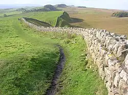
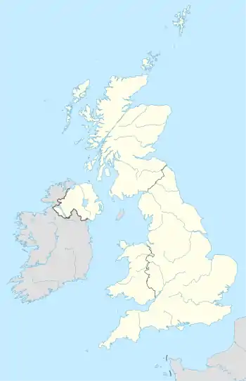
Adrian divarı (ing. Hadrian's Wall, lat. Vallum Hadriani) — 117 kilometr (73 mil) uzunluğunda və bir vaxtlar İngiltərənin şimalından keçmiş nəhəng Roma müdafiə quruluşu. 121-ci ildə tikilmişdir. Divarın cənub tərəfindəki qala boyunca hərbi yol keçirdi.[1]
| Adrian divarı | |
 | |
| Ölkə | |
|---|---|
| Tip | Mədəni |
| Kriteriya | (ii)[d], (iii)[d], (iv)[d] |
| Keçid | 430-001 |
| Daxil edilməsi | (qeyri-məlum sessiya) |
|
|
|
İstinadlar
- Энциклопедический словарь. 2009. АДРИАНОВ ВАЛ.
Əlavə ədəbiyyat
- Birley, A.R. Hadrians Wall Illustrated Guide. London: Her Majesty's Stationery Office (HMSO). 1963.
- Burton, Anthony. Hadrian's Wall Path. 2004. Aurum Press Ltd. ISBN 1-85410-893-X.
- Chaichian, Mohammad. 2014. "Hadrian's Wall: An Ill-Fated strategy for Tribal Management in Roman Britain", in Empires and Walls: Globalization, Migration, and Colonial Domination (Brill, pp. 23–52). https://www.amazon.com/Empires-Walls-Globalization-Migration-Domination/dp/1608464229.
- Davies, Hunter. A Walk along the Wall, 1974. Weidenfeld & Nicolson: London ISBN 0 297 76710 0.
- de la Bédoyère, Guy. Hadrian's Wall: A History and Guide. Stroud: Tempus, 1998. ISBN 0-7524-1407-0.
- England's Roman Frontier: Discovering Carlisle and Hadrian's Wall Country. Hadrian's Wall Heritage Ltd and Carlisle Tourism Partnership. 2010.
- Forde-Johnston, James L. Hadrian's Wall. London: Michael Joseph, 1978. ISBN 0-7181-1652-6.
- Hadrian's Wall Path (map). Harvey, 12–22 Main Street, Doune, Perthshire FK16 6BJ. harveymaps.co.uk
- Higgins, Charlotte. Chapter Seven: Hadrian's Wall // Under Another Sky: Journeys in Roman Britain. London: Vintage. 2014. ISBN 978-0-099552-09-3.
- Hodgson, Nick. Hadrian's Wall. Marlborough, UK: Robert Hale. 2017. ISBN 978-0-7198-1815-8.
- Moffat, Alistair, The Wall. 2008. Birlinn Limited Press. ISBN 1-84158-675-7.
- Shanks, Michael. "'Let me tell you about Hadrian's Wall ...' Heritage, Performance, Design". 2012.
- Speed, John – A set of Speed's maps were issued bound in a single volume in 1988 in association with the British Library and with an introduction by Nigel Nicolson as The Counties of Britain: A Tudor Atlas by John Speed.
- Tomlin, R. S. O., "Inscriptions" in Britannia (2004), vol. xxxv, pp. 344–5 (the Staffordshire Moorlands cup naming the Wall).
- Wilson, Roger J. A., A Guide to the Roman Remains in Britain. London: Constable & Company, 1980; ISBN 0-09-463260-X.
Xarici keçidlər
Vikianbarda Adrian divarı ilə əlaqəli mediafayllar var.
- In Our Time Radio series with Greg Woolf, Professor of Ancient History at the University of St Andrews, David Breeze, Former Chief Inspector of Ancient Monuments for Scotland and Visiting Professor of Archaeology at the University of Durham and Lindsay Allason-Jones OBE, FSA, FSA Scot, Former Reader in Roman Material Culture at the University of Newcastle
- Hadrian's Wall on the Official Northumberland Visitor website
- Hadrian's Wall Discussion Forum
- UNESCO Frontiers of the Roman Empire
- News on the Wall path
- English Lakes article
- iRomans—website with interactive map of Cumbrian section of Hadrian Wall
- Well illustrated account of sites along Hadrian's Wall
This article is issued from Wikipedia. The text is licensed under Creative Commons - Attribution - Sharealike. Additional terms may apply for the media files.
