 | |
| Alministración | |
| País | |
| País autónomu | |
| Conceyu | Avannaata (es) |
| Tipu d'entidá | mediu rural |
| Xeografía | |
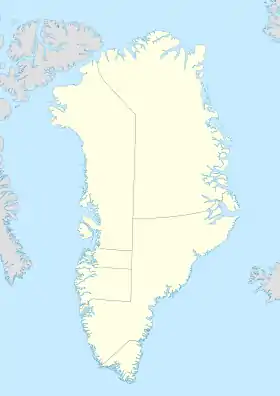
| Coordenaes | 77°47′08″N 70°38′00″W / 77.7856°N 70.6333°O |
 Siorapaluk Siorapaluk (Groenlandia) | |
| Superficie | 0.2 km² |
| Altitú | 14 m |
| Demografía | |
| Población | 43 hab. (1r xineru 2020) |
| Porcentaxe |
100% de Avannaata (es) 7.7102170425312E+82% de Groenlandia 7.3591069506753E+80% de Reinu de Dinamarca |
| Densidá | 215 hab/km² |
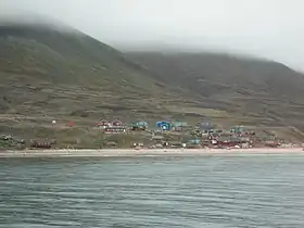
Siorapaluk (Hiurapaluk n'inuktun) ye un pobláu de la municipalidá de Qaanaaq, Groenlandia (Dinamarca) y ún de los asentamientos más septentrionales del mundu. Ye consideráu'l segundu pobláu “naturalmente habitáu” más cercanu al Polu Norte, (dempués de Ny-Alesund) argumentando que los pocos poblaos que lo superen en llatitú tán despoblaos, o son establecimientos militares o estaciones d'investigación. La so población (xineru de 2005) yera de 87 persones. El so allugamientu averáu ye de 77° 47'N, 70° 46'O. Los habitantes de Siorapaluk falen inuktun (dialeutu septentrional), según tamién groenlandés estándar occidental.
Ver tamién
- Poblaos más boreales
- Groenlandia
- Inuit
Referencies
- Statistics Greenland: Population Statistics Grønlands befolkning pr. 1. januar 2005 (23.02.2005). Del 2. Statistics Greenland. Only available in Danish and Greenlandic. Downloaded January 2006.
- Gazetteer of Greenland Compiled by Per Ivar Haug. UBiT, Universitetsbiblioteket i Trondheim, August 2005, ISBN 978-82-7113-114-2.
This article is issued from Wikipedia. The text is licensed under Creative Commons - Attribution - Sharealike. Additional terms may apply for the media files.