 | |
| Alministración | |
| País | |
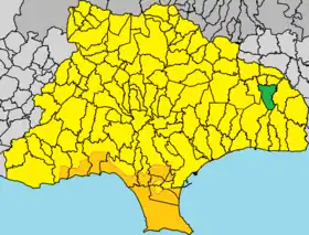
| Distritu | distritu de Limasol |
| Tipu d'entidá | villa de Xipre[1] |
| President of Communal Council of Sanida (en) |
Costas Christofi (es) |
| Nome oficial | Σανίδα (el)[2] |
| Nome llocal | Σανίδα (el)[2] |
| Códigu postal |
4510 |
| Xeografía | |
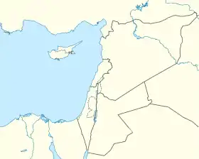
| Coordenaes | 34°48′28″N 33°11′23″E / 34.8078°N 33.1897°E |
 Sanida Sanida (Xipre)  | |
| Superficie | 10.6996 km² |
| Altitú | 605 m[3] |
| Llenda con | Klonari, Vikla, Vasa Kellakiou, Monagroulli, Pyrgos, Parekklisia y Kellaki |
| Demografía | |
| Población | 42 hab. (2011) |
| Porcentaxe |
0.02% de distritu de Limasol 0% de Xipre |
| Densidá | 3,93 hab/km² |
| Más información | |
| Estaya horaria |
UTC+02:00 (horariu estándar)[4] UTC+03:00 (horariu de branu)[4] |
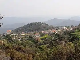
Sanida (en griegu: Σανίδα) ye una villa de Xipre, en distritu de Limasol. Tien una población de 42 habitantes (2011).[5]
Referencies
- ↑ «ΣΤΑΤΙΣΤΙΚΟΙ ΚΩΔΙΚΟΙ ΔΗΜΩΝ/ΚΟΙΝΟΤΗΤΩΝ ΚΑΙ ΕΝΟΡΙΩΝ ΤΗΣ ΚΥΠΡΟΥ, 2015» (griegu). Geographical codes of the Republic of Cyprus. CYSTAT. Archiváu dende l'orixinal, el 13 xineru 2018. Consultáu'l 13 xineru 2018.
- 1 2 Afirmao en: Walking Cyprus: Limassol (Town and District) (1st editiion). Páxina: 140-141. Autor: Giorgos Karouzis. Llingua de la obra o nome: griegu. Data d'espublización: 2001.
- ↑ «Κατάλογος κοινοτήτων επιλέξιμων μειονεκτικών περιοχών» (griegu,) páxs. 9. Cyprus Agricultural Payments Organization. Archiváu dende l'orixinal, el 4 abril 2018. Consultáu'l 4 abril 2018.
- 1 2 «Sanida» (inglés). Postcode Query. Archiváu dende l'orixinal, el 26 mayu 2018. Consultáu'l 26 mayu 2018.
- ↑ «Census of population 2011» (inglés) (2011-10-01). Archiváu dende l'orixinal, el 2018-01-02.
This article is issued from Wikipedia. The text is licensed under Creative Commons - Attribution - Sharealike. Additional terms may apply for the media files.