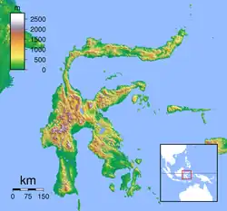
نهر لاريانغ
نهر لاريانغ هو نهر في سولاوسي، اندونيسيا. [1]
| نهر لاريانغ | |
|---|---|
| المنطقة | |
| البلد | |
| الخصائص | |
| المصب | مضيق ماكاسار |

لاريانغ
مصب نهر لاريانغ
دورة
روافده نهر باباتوا، ينشأ في منطقة دونجالا، سولاويسي الوسطى، ويشكل لاريانغ عندما ينضم لنهر كورو من اليسار (جنوب) في 1°39′50″S 120°2′47″E . يمتد النهر، مثل لاريانغ، [2] ليشكل جزءًا من الحدود بين سولاوسي الوسطى وسولاوسي الغربية ويدخل مضيق ماكاسار بجوار بلدة لاريانغ. [3] [4] المصب في 1°25′00″S 119°17′31″E .
انظر أيضا
- قائمة أنهار اندونيسيا
- قائمة أنهار سولاويزي
المراجع
- Rand McNally, The New International Atlas, 1993.
- Some maps such as "Lariang, Sulawesi Barat, Sulawesi, Indonesia". Collins Maps. مؤرشف من الأصل في 2013-06-28. and "City (town): Lariang". TipTopGlobe. مؤرشف من الأصل في 2018-12-05. no longer use the name Lariang, but use Pebatua for the entire length.
- "Plate 19 Indonesia Central: Philippines". Times Atlas of the World (ط. seventh). John Bartholomew and Sons, Ltd. 1985. ISBN:978-0-7230-0265-9.
- The 1964 U.S. Army topographic map Pasangkaju does not show the town of Lariang.
- بوابة إندونيسيا
- بوابة جغرافيا
- بوابة أنهار
This article is issued from Wikipedia. The text is licensed under Creative Commons - Attribution - Sharealike. Additional terms may apply for the media files.