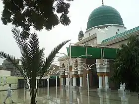
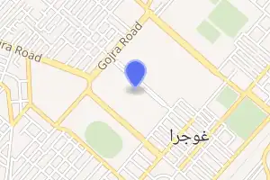
غوجرا
غوجرا (بالأردوية: گوجرہ) هي مستوطنة، في باكستان، تقع في Toba Tek Singh District [الإنجليزية]، بلغ عدد سكانها 157,863 نسمة وذلك حسب إحصائيات سنة 2017، تبلغ مساحتها 1,115 كيلومتر مربع، رمزها البريدي هو 36120.[2][3]"The business done in this rising mart on the railway, which has sprung into existence in the last six years owing to the extension of the Chenab Canal to the surrounding country, bides fair to rival in importance that of Faisalabad itself".</ref>[3]
| غوجرا | |
|---|---|
 | |
| تاريخ التأسيس | 1896 |
| تقسيم إداري | |
| البلد | |
| خصائص جغرافية | |
| إحداثيات | 31°09′00″N 72°41′00″E |
| المساحة | 1,115 كيلومتر مربع |
| الارتفاع | 465 متر |
| السكان | |
| التعداد السكاني | 157,863 نسمة (إحصاء 2017) |
| معلومات أخرى | |
| التوقيت | توقيت باكستان |
| الرمز البريدي | 36120 |
| الموقع الرسمي | الموقع الرسمي |
| الرمز الجغرافي | 1178231 |
 | |
أعلام
مراجع
- "صفحة غوجرا في GeoNames ID". GeoNames ID. اطلع عليه بتاريخ 2024-03-23.
- Punjab disturbances, April 1919; compiled from the Civil and Military Gazette. (1919)
- "Gojra – Imperial Gazetteer of India, v. 12, p. 306". Dsal. uchicago.edu. مؤرشف من الأصل في 2016-03-03. اطلع عليه بتاريخ 2011-10-18.
- بوابة تجمعات سكانية
- بوابة باكستان
This article is issued from Wikipedia. The text is licensed under Creative Commons - Attribution - Sharealike. Additional terms may apply for the media files.