Grens tussen Suid-Afrika en Lesotho
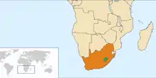
Die grens tussen Suid-Afrika en Lesotho is 1 106 kilometer (687 myl) lank[1] en vorm 'n voltooide sirkel, omrede Lesotho ingesluit en omring word deur Suid-Afrika aan al sy grense.

Die grens tussen Lesotho (groen) en Suid-Afrika (oranje)

Lesotho word in sy geheel deur Suid-Afrika omring

Suid-Afrikaanse grenspos by die Sanipas

Pekabrug, 'n grenspos aan die Suid-Afrikaanse kant
Die grens volg die Caledonrivier, die waterskeiding van die Drakensberg, die Telerivier, die Oranjerivier, die Makhalengrivier, en 'n reeks hoë gebergtes terug tot by die Caledon.
Grensposte
Hier is 'n lys van grensposte tussen Suid-Afrika en Lesotho.[2][3]
| Grenspos | Ure oop | Provinsie | Buurland |
|---|---|---|---|
| Boesmansnek | 08:00–16:00 | KwaZulu-Natal | Lesotho |
| Caledonspoort | 06:00–22:00 | Vrystaat | Lesotho |
| Ficksburgbrug | 24 uur | Vrystaat | Lesotho |
| Makhalengbrug | 08:00–16:00 | Vrystaat | Lesotho |
| Maserubrug | 24 uur | Vrystaat | Lesotho |
| Monantsapas | 08:00–16:00 | Vrystaat | Lesotho |
| Ongeluksnek | 08:00–16:00 | Oos-Kaap | Lesotho |
| Pekabrug | 08:00–16:00 | Vrystaat | Lesotho |
| Qachasnek | 06:00–22:00 | Oos-Kaap | Lesotho |
| Ramatseliso's Gate | 08:00–16:00 | Oos-Kaap | Lesotho |
| Sanipas | 06:00–18:00 | KwaZulu-Natal | Lesotho |
| Sepapushek | 08:00–16:00 | Vrystaat | Lesotho |
| Telebrug | 06:00–22:00 | Oos-Kaap | Lesotho |
| Van Rooyenshek | 08:00–22:00 | Vrystaat | Lesotho |
Verwysings
- Central Intelligence Agency (2 April 2018). "South Africa" (in Engels). The World Factbook. Geargiveer vanaf die oorspronklike op 11 Mei 2020. Besoek op 14 April 2018.
- (af) Die Suid-Afrikaanse Gids – feite en wenke. 2009. Isabel Uys. ISBN 978-1-86919-324-9
- (en) "South African Ports of Entry". Departement van Binnelandse Sake. Geargiveer vanaf die oorspronklike op 28 Augustus 2015. Besoek op 14 April 2018.
| Grense van Suid-Afrika | |||
|---|---|---|---|
|
Namibië • Botswana • Zimbabwe • Mosambiek • Eswatini • Lesotho | |||
This article is issued from Wikipedia. The text is licensed under Creative Commons - Attribution - Sharealike. Additional terms may apply for the media files.