File:CEI members.svg

Size of this PNG preview of this SVG file: 587 × 600 pixels. Other resolutions: 235 × 240 pixels | 470 × 480 pixels | 752 × 768 pixels | 1,002 × 1,024 pixels | 2,004 × 2,048 pixels | 593 × 606 pixels.
Original file (SVG file, nominally 593 × 606 pixels, file size: 709 KB)
Captions
Captions
Add a one-line explanation of what this file represents
Summary
edit
| Description |
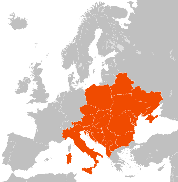
English: Map of CEI members.
Hrvatski: Karta članica Srednjoeuropske inicijative. |
| Date | |
| Source | Hmxhmx. Based on this file on Commons. |
| Author | Hmxhmx |
| This is a retouched picture, which means that it has been digitally altered from its original version. Modifications: Colored countries in the appropriate colors.
|
Licensing
edit
I, the copyright holder of this work, hereby publish it under the following licenses:

|
Permission is granted to copy, distribute and/or modify this document under the terms of the GNU Free Documentation License, Version 1.2 or any later version published by the Free Software Foundation; with no Invariant Sections, no Front-Cover Texts, and no Back-Cover Texts. A copy of the license is included in the section entitled GNU Free Documentation License. |
This file is licensed under the Creative Commons Attribution-Share Alike 4.0 International license.
- You are free:
- to share – to copy, distribute and transmit the work
- to remix – to adapt the work
- Under the following conditions:
- attribution – You must give appropriate credit, provide a link to the license, and indicate if changes were made. You may do so in any reasonable manner, but not in any way that suggests the licensor endorses you or your use.
- share alike – If you remix, transform, or build upon the material, you must distribute your contributions under the same or compatible license as the original.
You may select the license of your choice.
File history
Click on a date/time to view the file as it appeared at that time.
| Date/Time | Thumbnail | Dimensions | User | Comment | |
|---|---|---|---|---|---|
| current | 09:38, 9 December 2022 | | 593 × 606 (709 KB) | Iktsokh (talk | contribs) | Correction of borders |
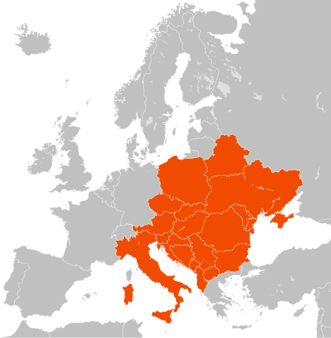
| 16:06, 6 December 2018 |  | 593 × 606 (703 KB) | Pavlo.dudka (talk | contribs) | highlighted Crimea | |
| 18:40, 11 June 2018 |  | 593 × 606 (703 KB) | Hmxhmx (talk | contribs) | {{Information |description ={{en|1=Map of CEI members.}} {{hr|1=Karta članica Srednjoeuropske inicijative.}} |date =2018-06-11 |source =Hmxhmx. Based on this file on Commons. |author =Hmxhmx }} Category:Central European Initiative Category:SVG maps of Europe |
You cannot overwrite this file.
File usage on Commons
The following 2 pages use this file:
File usage on other wikis
The following other wikis use this file:
- Usage on ar.wikipedia.org
- Usage on ast.wikipedia.org
- Usage on az.wikipedia.org
- Usage on be.wikipedia.org
- Usage on bg.wikipedia.org
- Usage on cs.wikipedia.org
- Usage on de.wikipedia.org
- Usage on el.wikipedia.org
- Usage on en.wikipedia.org
- Usage on es.wikipedia.org
- Usage on fr.wikipedia.org
- Usage on he.wikipedia.org
- Usage on hr.wikipedia.org
- Usage on it.wikipedia.org
- Usage on jv.wikipedia.org
- Usage on ko.wikipedia.org
- Usage on lt.wikipedia.org
- Usage on pl.wikipedia.org
- Albania
- Austria
- Bośnia i Hercegowina
- Bułgaria
- Chorwacja
- Macedonia Północna
- Mołdawia
- Rumunia
- Słowacja
- Słowenia
- Ukraina
- Węgry
- Serbia
- Czarnogóra
- Białoruś
- Polska
- Włochy
- Inicjatywa Środkowoeuropejska
- Czechy
- Ukraina w organizacjach międzynarodowych
- Szablon:Inicjatywa Środkowoeuropejska
- Wikipedysta:Krystian Kuchta/brudnopis
- Wikipedysta:TheLightBlue/brudnopis
- Usage on ro.wikipedia.org
- Usage on ru.wikipedia.org
- Usage on simple.wikipedia.org
- Usage on sl.wikipedia.org
- Usage on sr.wikipedia.org
- Usage on sv.wikipedia.org
- Usage on uk.wikipedia.org
View more global usage of this file.