File:Sweden location map, 40south.svg

Size of this PNG preview of this SVG file: 519 × 600 pixels. Other resolutions: 208 × 240 pixels | 415 × 480 pixels | 664 × 768 pixels | 886 × 1,024 pixels | 1,772 × 2,048 pixels | 636 × 735 pixels.
Original file (SVG file, nominally 636 × 735 pixels, file size: 1.25 MB)
Captions
Captions
Add a one-line explanation of what this file represents
| Description |
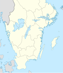
English: Location map of the lower 40% of Sweden
Equirectangular projection, N/S stretching 190 %. Geographic limits of the map:
|
||
| Date | |||
| Source | Sweden location map.svg by NordNordWest cropped so as to only include bottom 40% | ||
| Author | NordNordWest | ||
| Permission (Reusing this file) |
License remains the same as for original NordNordWest, the copyright holder of this work, hereby publishes it under the following licenses:
This file is licensed under the Creative Commons Attribution-Share Alike 3.0 Unported license. Attribution: NordNordWest
You may select the license of your choice. |
||
| Other versions | Derivative works of this file: Allsvenskan 2010 fotboll karta.jpg |

File history
Click on a date/time to view the file as it appeared at that time.
| Date/Time | Thumbnail | Dimensions | User | Comment | |
|---|---|---|---|---|---|
| current | 20:55, 1 November 2015 | | 636 × 735 (1.25 MB) | Larske (talk | contribs) | Correction of border between Västra Götalands län and Jönköpings län. Habo municipality and Mullsjö municipality belong to Jönköpings län. |
| 16:27, 7 February 2009 |  | 636 × 735 (1.48 MB) | Lokal Profil (talk | contribs) | crop to east | |
| 15:29, 7 February 2009 |  | 954 × 735 (1.46 MB) | Lokal Profil (talk | contribs) | {{Information |Description={{en|Location map of the lower 40% of Sweden}} Equirectangular projection, N/S stretching 190 %. Geographic limits of the map: * N: 60.86° N * S: 55.1° N * W: 10.4° E * E: 24.6° E |Source=[[:File:Sweden locati |
You cannot overwrite this file.
File usage on Commons
The following 2 pages use this file:
File usage on other wikis
The following other wikis use this file:
- Usage on als.wikipedia.org
- Usage on ar.wikipedia.org
- Usage on ban.wikipedia.org
- Usage on bn.wikipedia.org
- Usage on bs.wikipedia.org
- Usage on ca.wikipedia.org
- Usage on ceb.wikipedia.org
- Usage on ckb.wikipedia.org
- Usage on da.wikipedia.org
- Skansen (Stockholm)
- Kastlösa
- Nässjö
- VM i håndbold 2011 (mænd)
- Helleristningerne i Tanum
- Mariestad
- Kulturlandskabet Søndre Øland
- Skabelon:Kortpositioner Sverige (syd)
- Friends Arena
- Skede (Sverige)
- VM i håndbold 2023 (mænd)
- Frantzén
- Hotel Tylösand
- Division II i ishockey 1941-42
- Division II i ishockey 1942-43
- Division II i ishockey 1943-44
- Klara Kirke
- Usage on de.wikipedia.org
- Fußball-Weltmeisterschaft 1958
- Fußball-Weltmeisterschaft 1958/Deutschland
- Vätternrundan
- Kernkraftwerk Oskarshamn
- Fotbollsallsvenskan 2006
- Fotbollsallsvenskan 2007
- Fotbollsallsvenskan 1998
- Wikipedia:Kartenwerkstatt/Positionskarten/Europa
- Fotbollsallsvenskan 2009
- Fotbollsallsvenskan 1999
- Handbollsligan
- Handball-Weltmeisterschaft der Männer 2011
- Wikipedia:Kartenwerkstatt/Archiv/2009-03
- Vorlage:Positionskarte Schweden Süd
- Fotbollsallsvenskan 2010
- Fußball-Europameisterschaft der Frauen 2013
- Fotbollsallsvenskan 2011
- Eishockey-Weltmeisterschaft der U18-Junioren 2006
View more global usage of this file.