File:Locator map of Arrondissement Morlaix 2017.png
Size of this preview: 800 × 460 pixels. Other resolutions: 320 × 184 pixels | 640 × 368 pixels | 1,024 × 589 pixels | 1,280 × 737 pixels | 2,499 × 1,438 pixels.
Original file (2,499 × 1,438 pixels, file size: 878 KB, MIME type: image/png)
Captions
Captions
Add a one-line explanation of what this file represents
| Description |
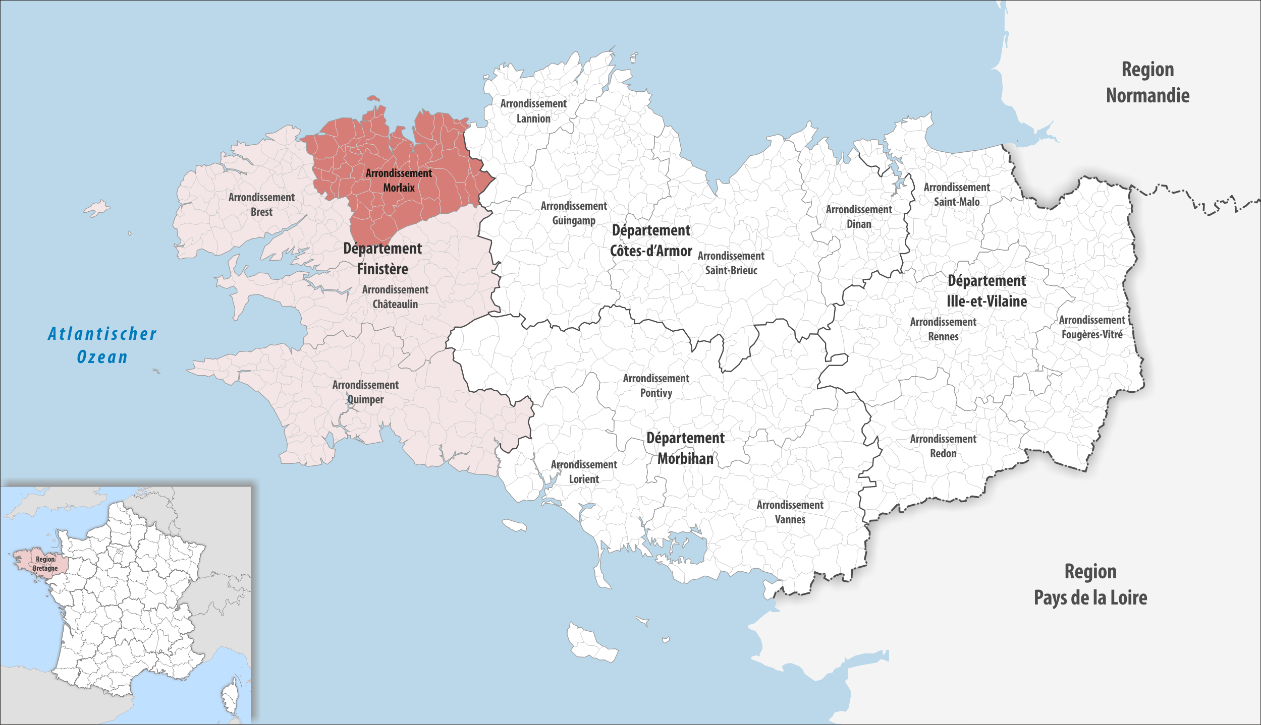
Deutsch: Lage des Arrondissements Morlaix |
||||||||
| Date | |||||||||
| Source | Own work | ||||||||
| Author | Tschubby | ||||||||
| Permission (Reusing this file) |
I, the copyright holder of this work, hereby publish it under the following licenses:
This file is licensed under the Creative Commons Attribution-Share Alike 2.5 Generic, 2.0 Generic and 1.0 Generic license.
You may select the license of your choice. |

File history
Click on a date/time to view the file as it appeared at that time.
| Date/Time | Thumbnail | Dimensions | User | Comment | |
|---|---|---|---|---|---|
| current | 21:17, 7 July 2017 | | 2,499 × 1,438 (878 KB) | Tschubby (talk | contribs) | {{Information |Description= |Source= |Date= |Author= |Permission= |other_versions= }} |
| 09:12, 29 March 2017 |  | 2,499 × 1,438 (879 KB) | Tschubby (talk | contribs) | {{Information |Description= {{de| Gemeinden, Kantone und Departemente in der Region Bretagne bis am 31. Dezember 2016}} |Source={{own}} |Date= 2016-12-31 |Author= Tschubby |Permission= {{self|GFDL|Cc-by-sa-3.0-migrated|Cc-by-sa-2.... | |
| 15:33, 25 November 2016 |  | 2,499 × 1,438 (879 KB) | Tschubby (talk | contribs) | {{Information |Description= |Source= |Date= |Author= |Permission= |other_versions= }} | |
| 14:38, 12 October 2016 |  | 2,499 × 1,438 (806 KB) | Tschubby (talk | contribs) | {{Information |Description= {{de|Lage des Arrondissements Morlaix}} |Source={{own}} |Date= 2016-10-12 |Author= Tschubby |Permission= {{self|GFDL|Cc-by-sa-3.0-migrated|Cc-by-sa-2.5,2.0,1.0}} |other_versions= }} [[Category:Locator... |
You cannot overwrite this file.
File usage on Commons
The following page uses this file:
- File:Locator map of Arrondissement Morlaix.png (file redirect)
File usage on other wikis
The following other wikis use this file:
- Usage on als.wikipedia.org
- Usage on fa.wikipedia.org