File:Alpenglühen 5236.jpg

Size of this preview: 800 × 408 pixels. Other resolutions: 320 × 163 pixels | 640 × 327 pixels | 1,024 × 523 pixels | 1,280 × 654 pixels | 3,118 × 1,592 pixels.
Original file (3,118 × 1,592 pixels, file size: 1.28 MB, MIME type: image/jpeg)
Captions
Captions
Add a one-line explanation of what this file represents
Summary
edit
| Description |
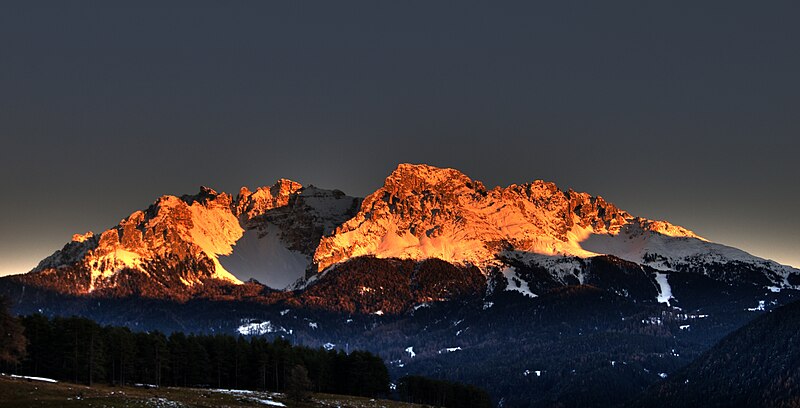
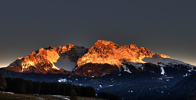
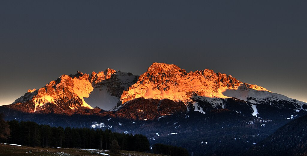
English: Alpenglow at Latemar, Dolomites. View from Schwarzenbach (Rio Nero), Deutschnofen (Nova Ponente).
Deutsch: Alpenglühen am Latemar in den Dolomiten. Gesehen von Schwarzenbach (Rio Nero) in der Nähe von Deutschnofen (Nova Ponente) aus. |
| Date | |
| Source | Own work |
| Author | Afrank99 |
| Camera location | | View this and other nearby images on: OpenStreetMap |
|---|
Licensing
edit
I, the copyright holder of this work, hereby publish it under the following license:
This file is licensed under the Creative Commons Attribution-Share Alike 3.0 Unported license.
- You are free:
- to share – to copy, distribute and transmit the work
- to remix – to adapt the work
- Under the following conditions:
- attribution – You must give appropriate credit, provide a link to the license, and indicate if changes were made. You may do so in any reasonable manner, but not in any way that suggests the licensor endorses you or your use.
- share alike – If you remix, transform, or build upon the material, you must distribute your contributions under the same or compatible license as the original.
File history
Click on a date/time to view the file as it appeared at that time.
| Date/Time | Thumbnail | Dimensions | User | Comment | |
|---|---|---|---|---|---|
| current | 18:08, 13 May 2009 | | 3,118 × 1,592 (1.28 MB) | Afrank99 (talk | contribs) | {{Information |Description={{en|1=en:Alpenglow near en:Bolzano}} {{de|1=de:Alpenglühen nahe de:Bozen in de:Südtirol}} |Source=Eigenes Werk (own work) |Author=Afrank99 |Date=2008-11-15 |Permission= |other_versio |
You cannot overwrite this file.
File usage on Commons
File usage on other wikis
The following other wikis use this file:
- Usage on als.wikipedia.org
- Usage on cs.wikipedia.org
- Usage on de.wikipedia.org
- Usage on de.wiktionary.org
- Usage on hr.wikipedia.org
- Usage on ms.wikipedia.org
- Usage on nl.wiktionary.org
- Usage on sh.wikipedia.org