File:Karte Silsersee.png

Size of this preview: 642 × 600 pixels. Other resolutions: 257 × 240 pixels | 514 × 480 pixels | 885 × 827 pixels.
Original file (885 × 827 pixels, file size: 139 KB, MIME type: image/png)
Captions
Captions
Add a one-line explanation of what this file represents
| Description |
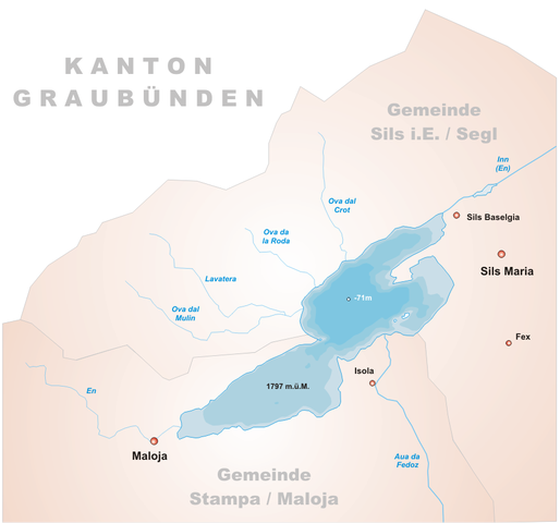
English: Map of Lake Sils, Switzerland
Deutsch: Karte Silsersee, Schweiz
Rumantsch: Charta dal Lai da Segl/Lej da Segl, Svizra |
||||||||
| Source | Tschubby | ||||||||
| Author | Tschubby | ||||||||
| Permission (Reusing this file) |
|

File history
Click on a date/time to view the file as it appeared at that time.
| Date/Time | Thumbnail | Dimensions | User | Comment | |
|---|---|---|---|---|---|
| current | 18:10, 22 June 2005 | | 885 × 827 (139 KB) | Tschubby (talk | contribs) | *Description: Map of Silsersee, Switzerland *Designer: Tschubby *Licence: {{GFDL}} Category:Maps of Swiss lakes |
You cannot overwrite this file.
File usage on Commons
There are no pages that use this file.
File usage on other wikis
The following other wikis use this file:
- Usage on als.wikipedia.org
- Usage on de.wikipedia.org
- Usage on eo.wikipedia.org
- Usage on fr.wikipedia.org
- Usage on ht.wikipedia.org
- Usage on it.wikipedia.org
- Usage on nl.wikipedia.org
- Usage on pl.wikipedia.org
- Usage on rm.wikipedia.org
- Usage on ru.wikipedia.org
- Usage on www.wikidata.org