File:RegionNordschwarzwald.png
Size of this preview: 432 × 599 pixels. Other resolutions: 173 × 240 pixels | 346 × 480 pixels | 791 × 1,097 pixels.
Original file (791 × 1,097 pixels, file size: 25 KB, MIME type: image/png)
Captions
Captions
Add a one-line explanation of what this file represents
| Description |
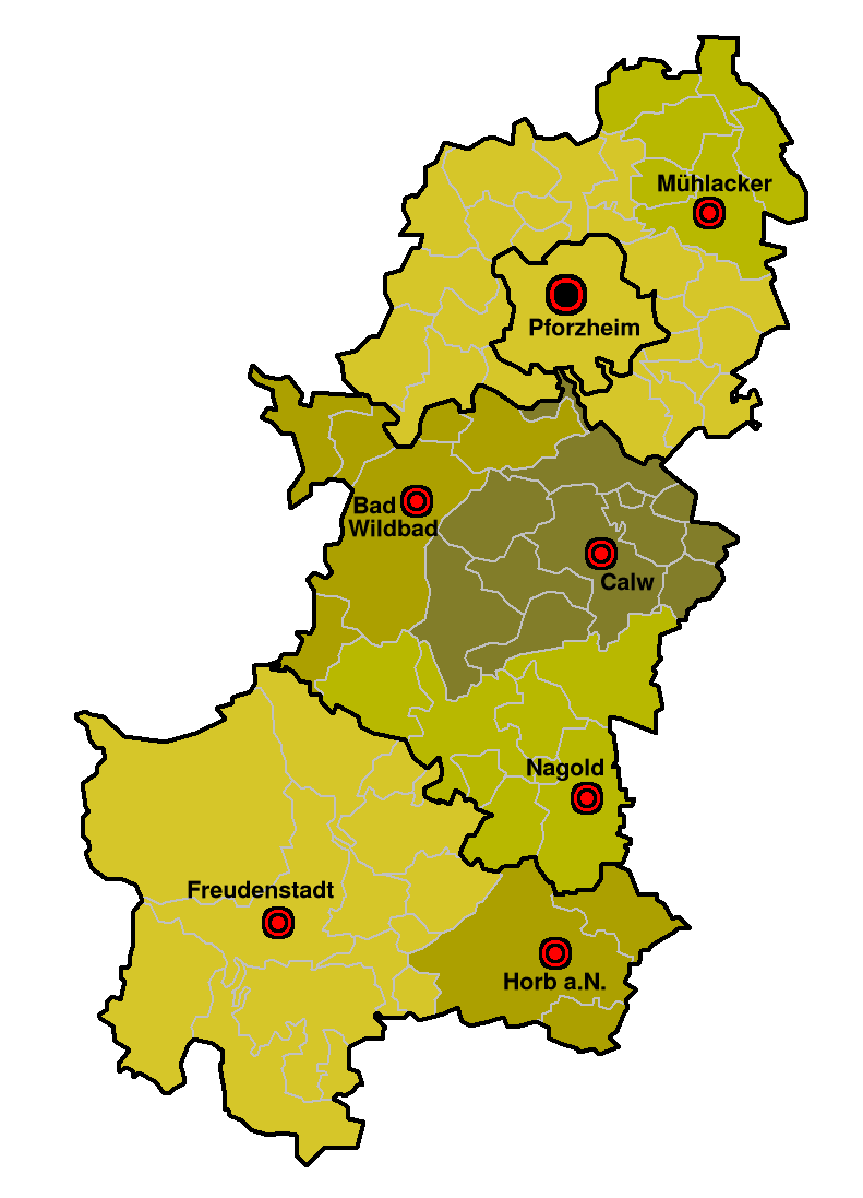
Deutsch: Karte der Mittelbereiche in der Region Nordschwarzwald
English: Maps of planning regions (Mittelbereiche) in the region Nordschwarzwald, Baden-Württemberg, Germany |
||||||||
| Date | |||||||||
| Source | Own work | ||||||||
| Author | Ssch | ||||||||
| Permission (Reusing this file) |
I, the copyright holder of this work, hereby publish it under the following licenses:
This file is licensed under the Creative Commons Attribution-Share Alike 2.0 Germany license.
 You may select the license of your choice. |

File history
Click on a date/time to view the file as it appeared at that time.
| Date/Time | Thumbnail | Dimensions | User | Comment | |
|---|---|---|---|---|---|
| current | 19:13, 1 March 2007 | | 791 × 1,097 (25 KB) | Ssch~commonswiki (talk | contribs) | {{Information| |Description = de: Karte der Mittelbereiche in der Region Nordschwarzwald<br/> en: Maps of planning regions (Mittelbereiche) in the region Nordschwarzwald, Baden-Württemberg, Germany |Source = drawn by myself |Date = November 2005 |Author |
You cannot overwrite this file.
File usage on Commons
There are no pages that use this file.
File usage on other wikis
The following other wikis use this file:
- Usage on als.wikipedia.org
- Usage on de.wikipedia.org
- Usage on eo.wikipedia.org
- Usage on fr.wikipedia.org